- +385 (0)20 813 619
- Obala 3 br. 19, Vela Luka
26°C 
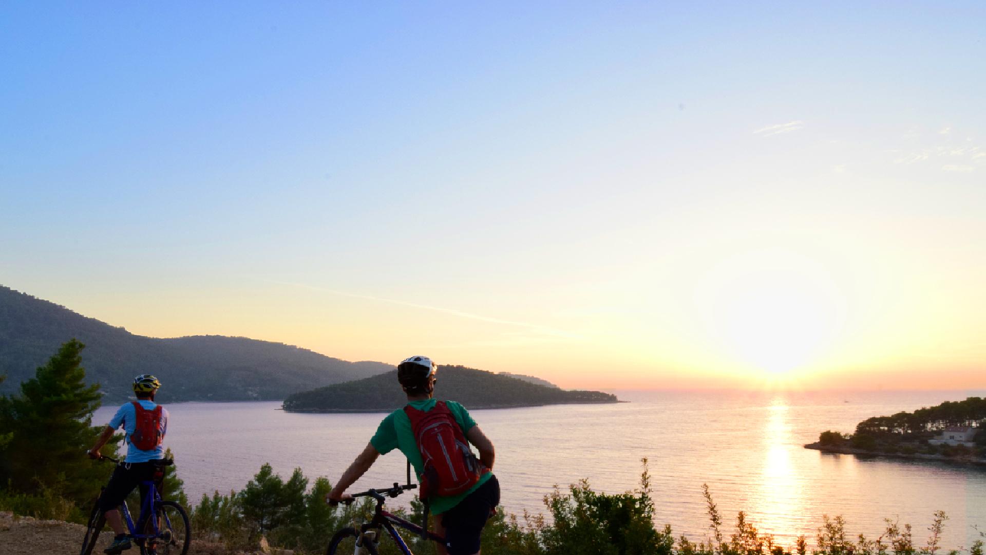
Discover how dry stone construction defined island landscape while enjoying an unforgettable sunset
Route B
Starts at the very end of Vela Luka bay, and leads us through the coves of the same bay. After exiting the town, we will reach a gravel road that is, with several asphalted segments, the basis of the greater part of the route. Without any major ascents, we pass above picturesque coves that house many vacation houses and small beaches perfect for enjoying sea pleasures.
First major ascent awaits on the 5th kilometer and leads us to the north coast of the island, characterized by a wealth and precision of dry stone construction. We can expect several kilometers of ascent at the end of the route, that will take us toward the pass above Vela Luka, the town into which we descend, while, at the same time, enjoying the view of the town before us.
L'i nizio/La fine: Vela Luka
Ruta: Tudorovica - Tečar - Prapatna
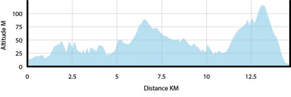
Lunghezza: 14.7 km
Altezza totale: +379 mnv, -381 mnv
Dificolta' fisica: 1/3
Superfice : asfalto/ macadam: makadam, asfalt
Dificolta' tecnica: 1/3


