- +385 (0)20 813 619
- Obala 3 br. 19, Vela Luka
27°C 

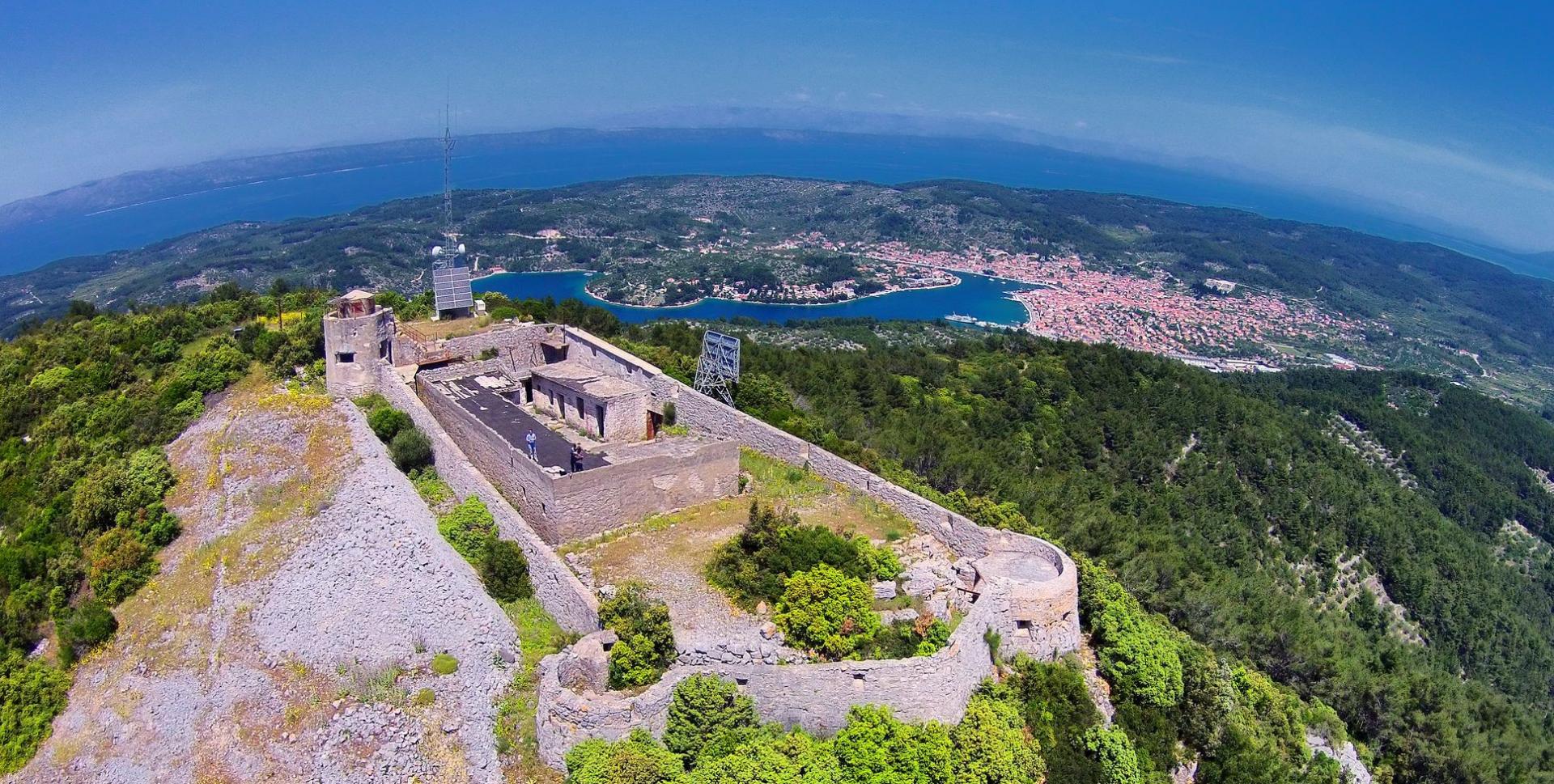
Along the coast up to Hum hill, the most beautiful viewpoint of Korčula island
About route C
At the beginning of this route we follow the road that leads to the point where a new ferry port is planned on being built. After the first kilometer of wide, newly built road, we come across a local road that will lead us to Poplat settlement. The road takes us alongside the south coast of Vela Luka bay, where several attractive beaches such as Gabrica, Pičena and Lučica are hidden. That part of the route also includes several short gravel segments, but the real challenge awaits after Poplat cove. The next 4 kilometers lead up to a 376 metres high Hum hill, the highest point on this side of Korčula island. On the top of the hill we will be rewarded with the views of the open sea, Adriatic islands, Dalmatian mountains and the island of Korčula below you.

start/finish Vela Luka
via: Poplat - Hum
lenght: 15.9 km
Ascent/descent altitude: +545mnv, -538mnv
Physical difficulty:: 2/3
Surface: asphalt/gravel road: asfalt, makadam
technical difficulty: 1/3