- +385 (0)20 813 619
- Obala 3 br. 19, Vela Luka
27°C 
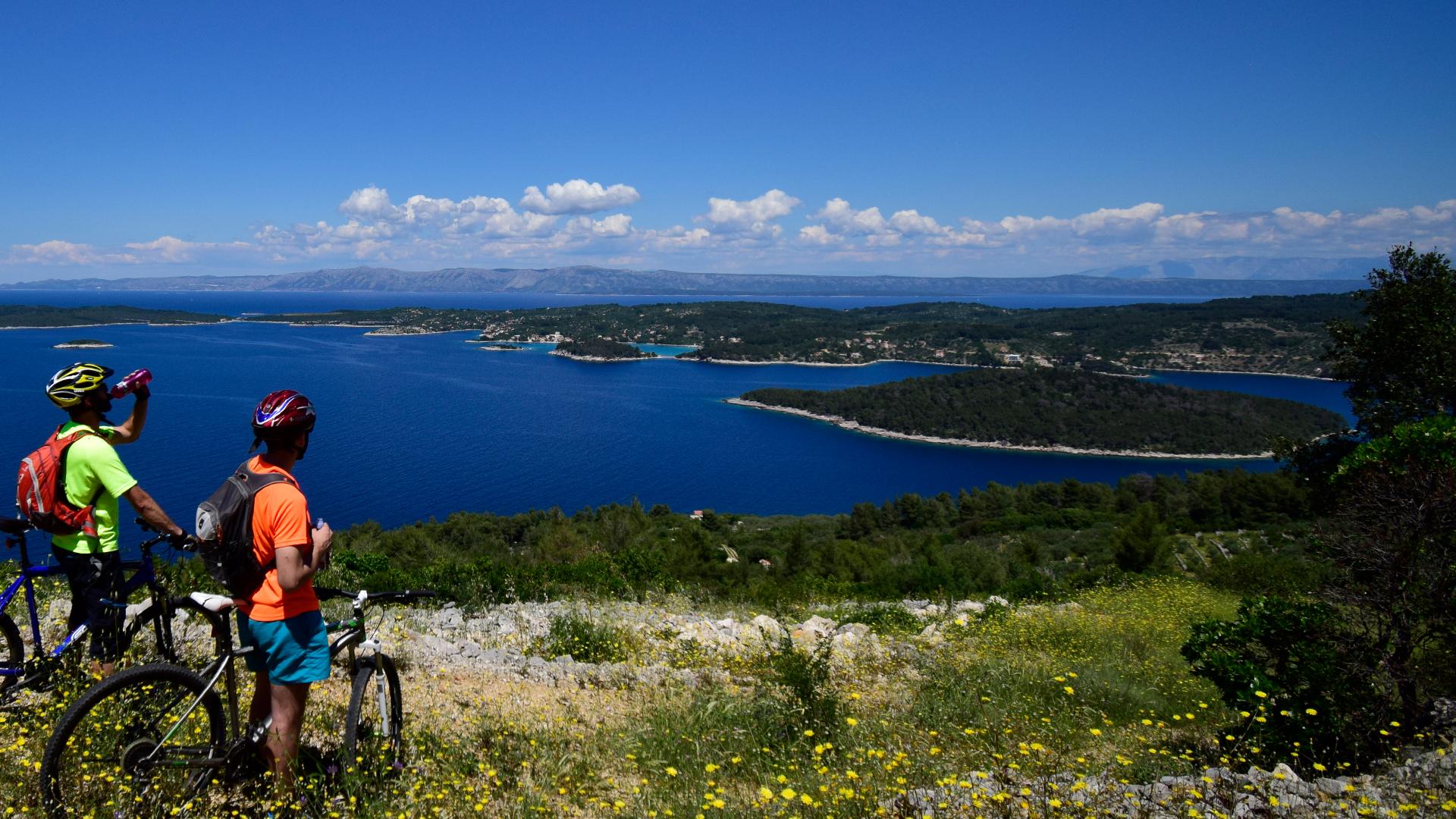
Via old settlements on the southern side of the island to the panoramic view of Vela Luka bay
About route D
The start of the route is marked by a gentle ascent via asphalt road toward the village of Potirna. After 3 kilometers we turn into a gravel road that leads us through an old, nowadays abandoned, village of Dub. The route soon narrows into an attractive single-track, from which we can enjoy views of the islands alongside the southern part of Korčula. Soon we will reach a road that leads through the village of Potirna, after which we can expect half of kilometer of steep ascent that leads to the most attractive part of the route. The gravel road through the pine forest takes us to the point high above the sea level, from which a beautiful view of Vela Luka bay stretches. The last six kilometers mark a gradual descent to the town, while the trail through the forest opens up new views of the bay.

start/finish Vela Luka
via: Dub - Potirna
lenght: 14.2 km
Ascent/descent altitude: +391 mnv, -413 mnv
Physical difficulty:: 1/3
Surface: asphalt/gravel road: makadam, asfalt, single track
technical difficulty: 2/3


